Norton's green, its semis and its drives
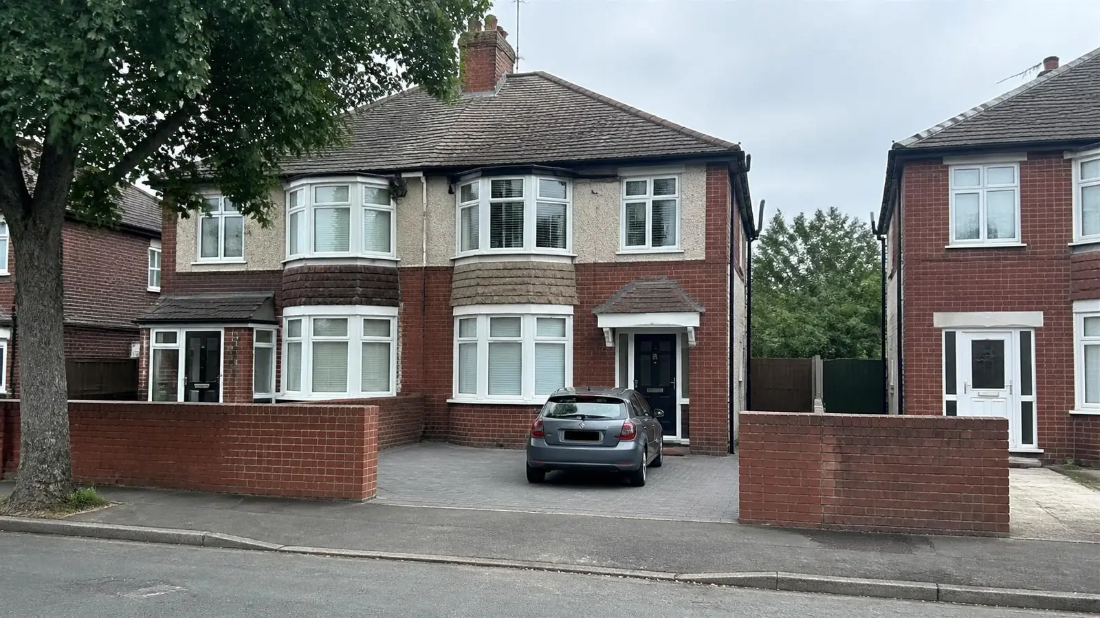
Norton covers three census wards, and they differ. In 2021 Norton West (2,828 households) was 56% semi-detached and 28% detached, with 83% owner-occupation and 42% of households running two or more vehicles. Norton South (3,115 households) was 53% semi-detached and 31% terraced, and Norton North (3,005) was 61% semi-detached with 14% flats. In those two wards, around 28% to 29% of households had no car.
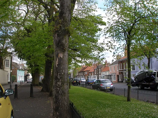
The historic core sits around The Green, the duck pond and St Mary's Church, with the High Street running north from it. Many buildings here are listed, including houses on the High Street such as No. 108 (Grade II*) and several on The Green. Beyond the core, Norton is mostly 20th-century housing, much of it bay-fronted inter-war semis with front gardens and low brick walls. The A1027 and Norton Road are the main traffic routes.
For driveways, Norton splits into two kinds of job:
- Old-village properties in the conservation area, where walls, railings, gate piers and the surface material all affect the look of the street.
- Inter-war and later semis outside it, where front gardens are often six to eight metres deep. That is usually enough for one car fully off the pavement, sometimes two in tandem.
Many of those semis still have their original low front wall. Keeping the piers and part of the wall, with an opening for the car, often looks better than clearing the whole frontage.
Sandy ground and flood risk in Norton
The British Geological Survey maps central Norton on glaciolacustrine sand, laid down in a glacial lake, over Sherwood Sandstone. Sand drains better than the clay till under much of west Stockton, which helps permeable drives and soakaways. The deposits vary, though, with clay and silt layers in places, so test before relying on a soakaway.
The Environment Agency's flood map shows central Norton in Flood Zone 1, with no river flood zone within about 300 metres but some Flood Zone 2 and 3 land within a kilometre. Check your postcode if you live on the lower ground at the edges of Norton.
The conservation area, Article 4 and kerbs
Norton Conservation Area was designated in 1969, one of the earliest in the borough. Stockton-on-Tees Borough Council describes it as roughly bounded by the A1027 to the north and Esk Road to the south, containing 81 listed buildings around the green, the pond, St Mary's Church and the High Street.
Parts of it are covered by an Article 4 Direction, which removes some permitted development rights. Where it applies, you may need planning permission to:
- lay a new hard surface at the front of the house;
- put up, alter or take down a front gate or boundary;
- demolish a front boundary wall.
Talk to the council's planning team before planning a drive that means losing an old wall or railings. Our conservation areas guide lists the questions to ask.
Outside the conservation area, normal householder rules apply: more than five square metres of hard surface draining onto the road needs permission, while a permeable surface does not. See permeable driveways.
Dropped kerbs. Busy roads such as Norton Road and the A1027 bring extra checks on visibility and safety. Elsewhere the borough-wide process applies: apply online for the council to assess, quote and build, or use a contractor with the council's Opening Up licence. There is no fixed published fee. See dropped kerbs in Stockton.
Planning a Norton drive
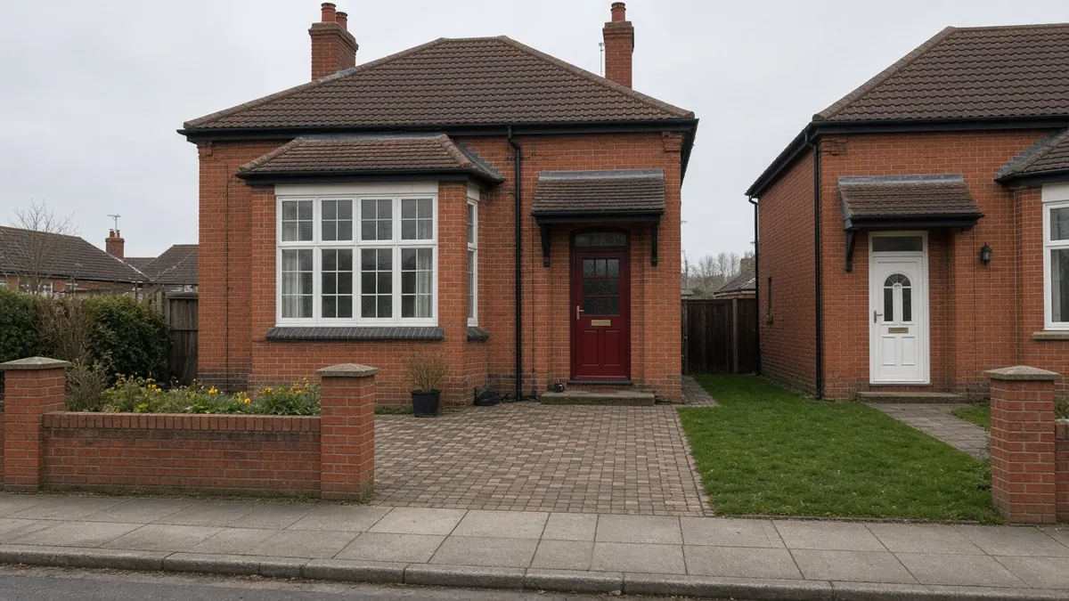
On an inter-war Norton semi, a single drive in the front garden is usually about 20m², and a tandem drive for two cars about 32m². The front wall and piers are often the deciding detail: widening a gateway can mean rebuilding a pier in matching brick, and in the conservation area any change to the wall may need planning permission first.
Wall alterations, reclaimed bricks for piers, digging out and the crossing itself all add to the surface. In the conservation area, materials chosen to match the street can cost more, but they are what keeps the frontage in character.
On period semis, block paving in a brindle or red tone suits the brick, resin bound gives a smooth permeable finish on the right base, and gravel with a block apron at the pavement is the low-cost free-draining choice.
Nearby areas
- Roseworth: to the west, a 1950s estate of semis where front lawns rarely have drives yet.
- Billingham: to the north-east, a separate town with its own conservation areas at Billingham Green, Wolviston and Cowpen Bewley.
- Hardwick: further west, with more terraces and rented homes.
All areas are listed on our areas page.
Questions people ask in Norton
Do I need planning permission for a drive near Norton Green?
Possibly. Parts of the Norton Conservation Area, designated in 1969, are covered by an Article 4 Direction, so a new front hard surface or a change to a front wall or gate can need permission. Check with Stockton-on-Tees Borough Council before you start.
Can I take down the front wall of my Norton semi?
Outside the conservation area, usually yes, though the dropped kerb still needs council approval. Inside the Article 4 area, demolishing or altering a front wall can need planning permission. Keeping the piers and part of the wall is often the better-looking option anyway.
Is Norton's ground good for a permeable drive?
Often. The British Geological Survey maps central Norton on sandy glacial lake deposits, which drain better than clay. The ground varies, so a simple soakage test is worth doing before relying on a soakaway.
How deep does a Norton front garden need to be for parking?
Around five to six metres from the house to the back of the footway is usually needed so a car does not overhang the pavement. Many Norton semis have six to eight metres, enough for one car and sometimes two in tandem.
Sources: ONS Census 2021, Norton North, Norton South and Norton West wards (TS044, TS045, TS054 via Nomis); Stockton-on-Tees Borough Council: Article 4 Directions (Norton conservation area); postcodes.io (ONS Postcode Directory): TS20 1AE; BGS Geology Viewer, 1:50,000; Environment Agency flood map for planning; Historic England: listed buildings on Norton High Street and The Green; Stockton-on-Tees Borough Council: apply for a driveway crossing.